
Kagoshima & Sakurajima
Kagoshima Prefecture, Japan
March 2024 & March 2025
We have now visited Kagoshima and Sakurajima twice, both times on Holland America cruises — first on the Westerdam in March 2024, and again on the Noordam almost exactly a year later. Both visits produced wonderful bike rides, but they were quite different from each other.
Sakurajima dominates Kagoshima Bay. It is one of Japan’s most active volcanoes, and it is very much alive. Ash plumes are part of normal life here.
Sakurajima was once an island, but a huge eruption in 1914 produced enough lava to connect it permanently to the Osumi Peninsula. It is still called an island, though, and from Kagoshima the easiest way to get there is still by ferry.
Our First Visit — March 2024
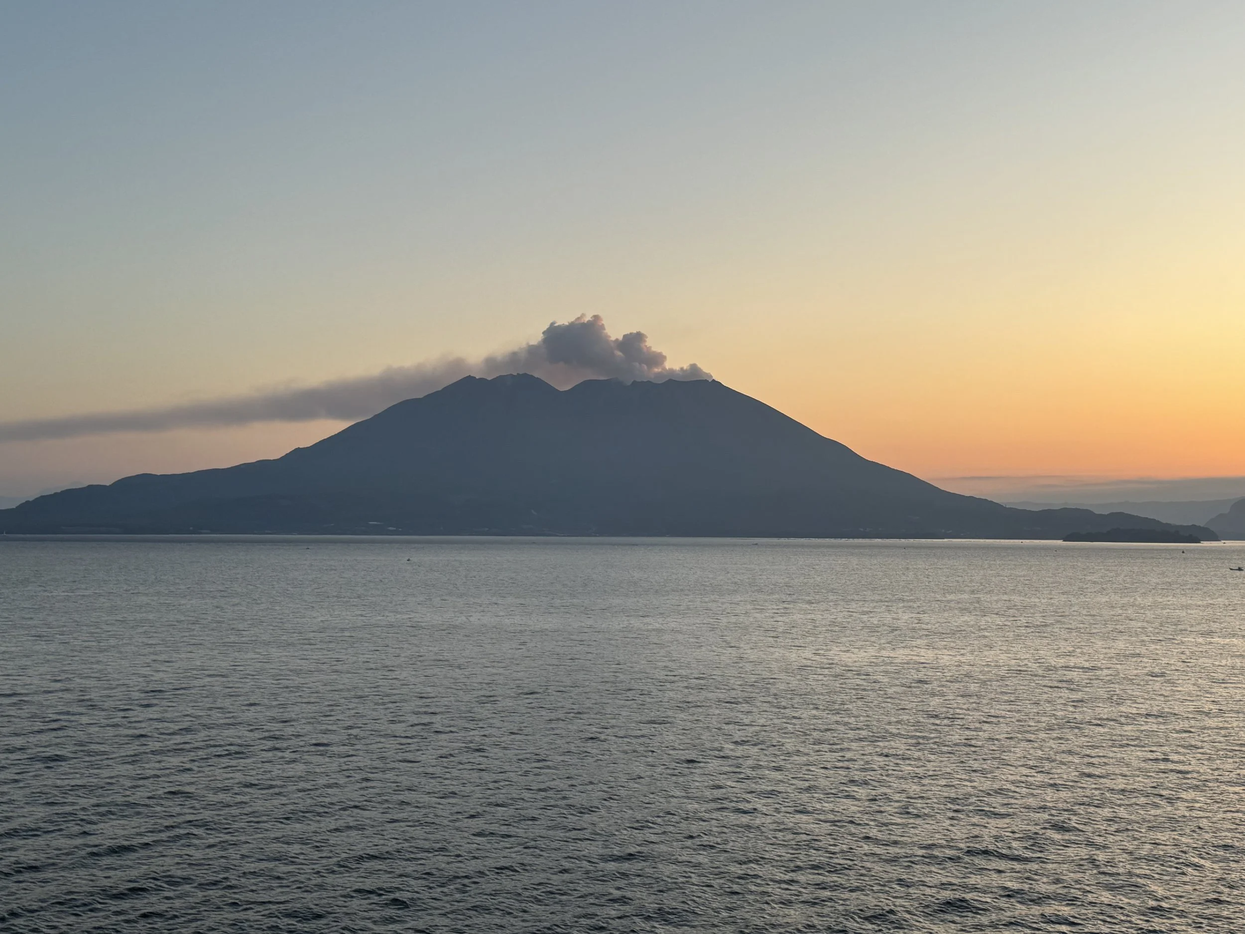
We sailed into Kagoshima Bay at dawn, with Sakurajima silhouetted against an orange sky and a long plume of ash streaming from the crater. It was one of those arrivals when you are very glad you got out of bed early.
By daylight, the haze had burned away and Sakurajima was sitting across the bay under a brilliant blue sky.
And it was erupting.
But not in a dramatic, run-for-your-life sort of way. This is Sakurajima, after all. But there was something decidedly thrilling about standing on the ship looking across the bay at an active volcano with ash rising from its summit, knowing that in a little while we were going to take our bicycles over there.
The cruise port is some distance from the Sakurajima ferry terminal, so we took the shuttle into Kagoshima with our folded Bromptons and then headed for the ferry.
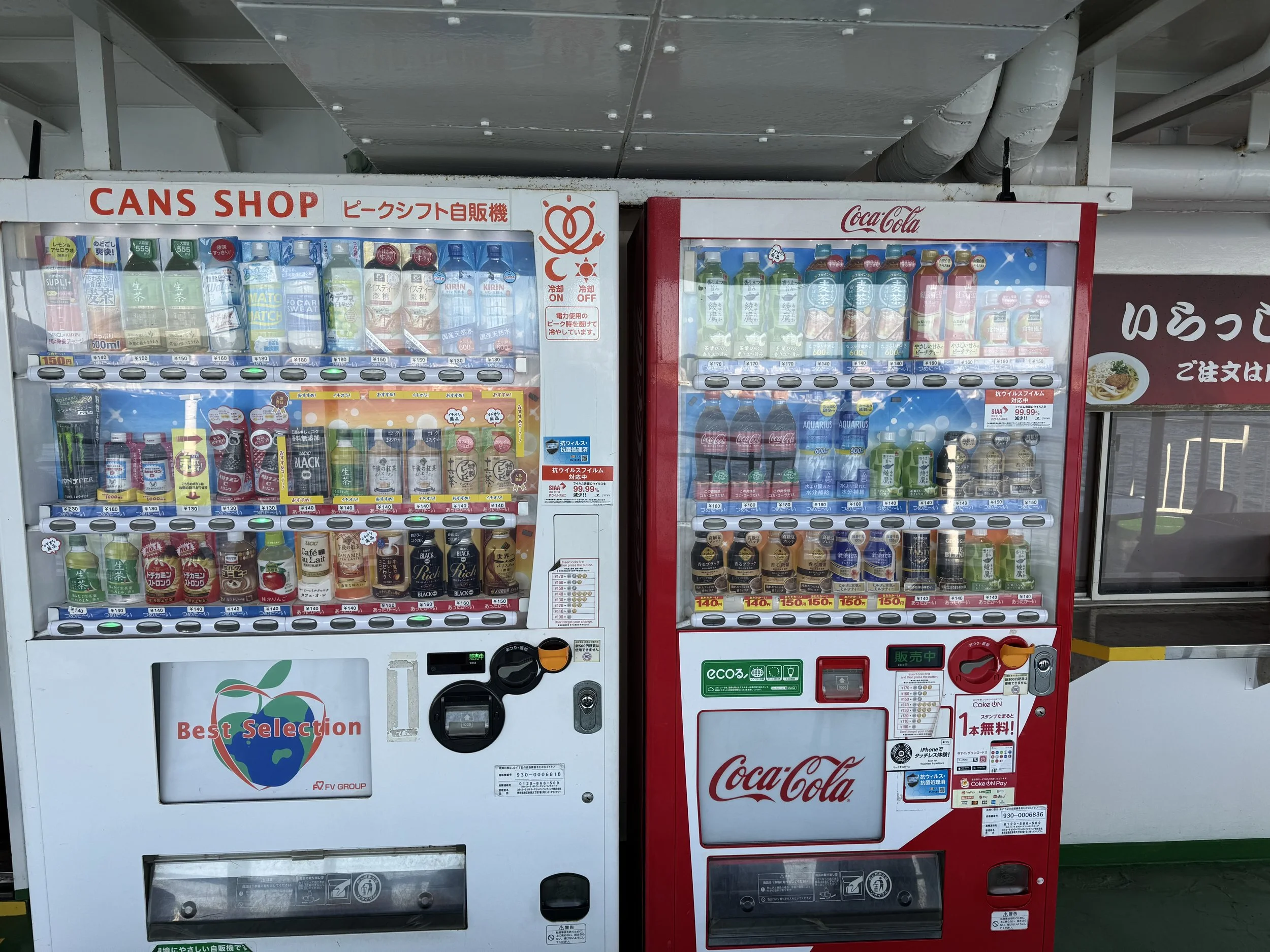
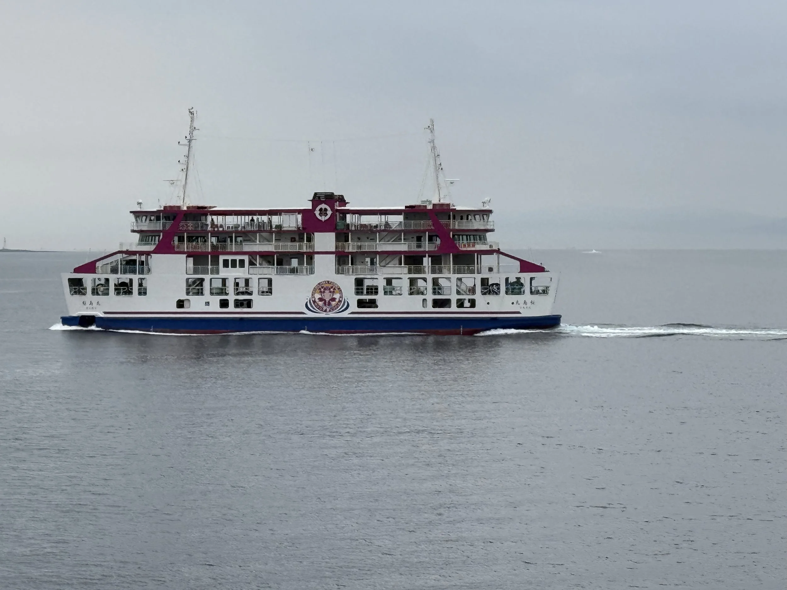
The ferry ride across Kagoshima Bay takes only about 20 minutes. Getting the bicycles aboard was remarkably easy. The attendants were exceptionally helpful and polite, helping us figure out the tickets and showing us exactly where to go with the bikes. There is just enough time on the ferry to eat a bowl of ramen or drink a bottle of milk tea from the vending machine. There are vending machines on board, because of course there are. This is Japan.
Once on Sakurajima, one of our first stops was the Sakurajima Visitor Center.
It is excellent.
There are very good exhibits about the volcano and what it is like to live beside it, an informative movie with English subtitles, and a genuinely interesting little gift shop. Among other things, they sold socks dyed using volcanic ash. We bought some.
In our travels through Japan, we saw a number of places where the Japanese have made disaster preparedness a part of the landscape.
We actually made a presentation about it:
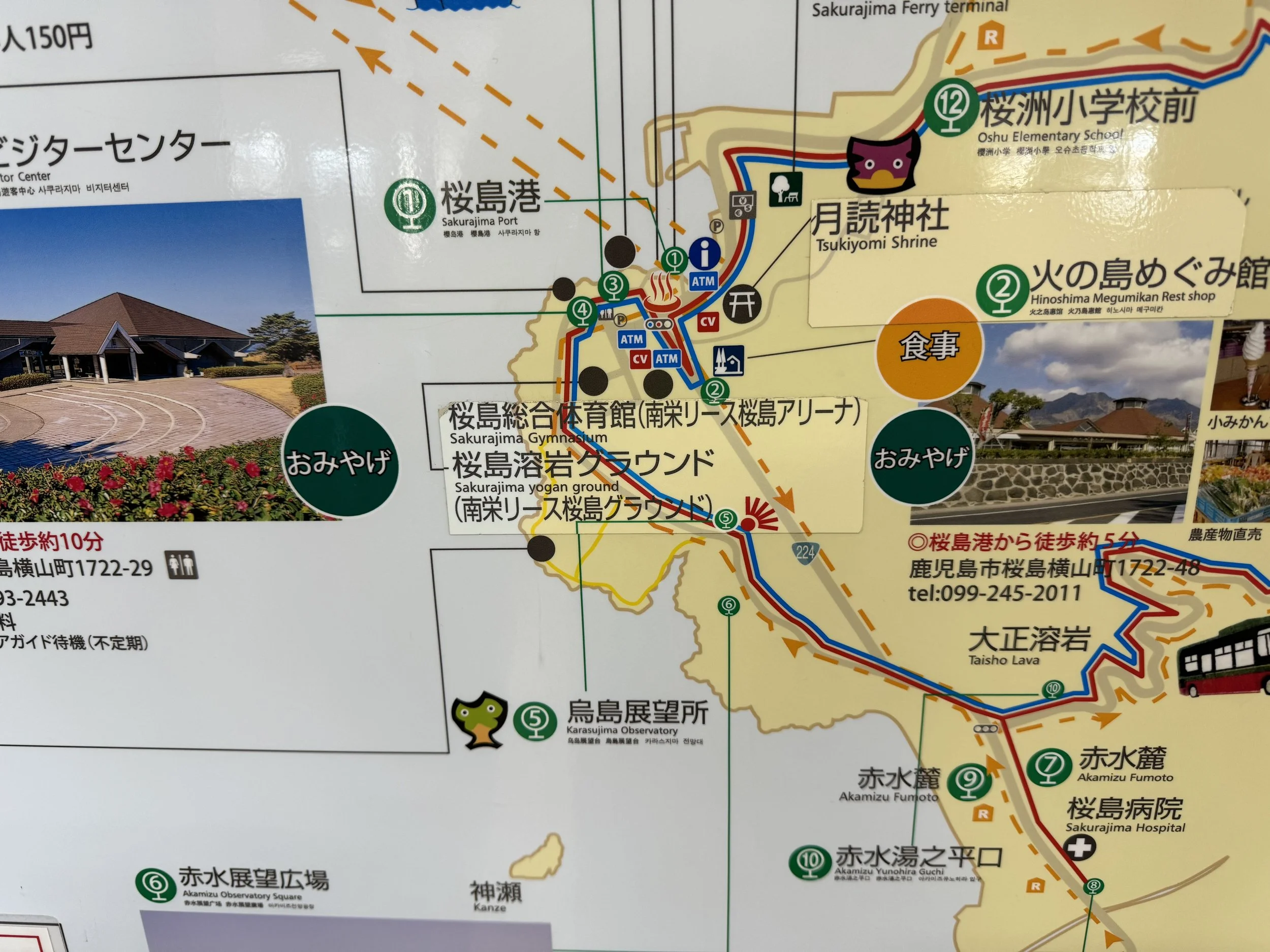
The Visitor Center was where we began to understand how completely life on Sakurajima is organized around the volcano.
Residents have special bags for volcanic ash. They sweep up the ash that falls around their homes and streets, put it into the bags and set it out for collection.
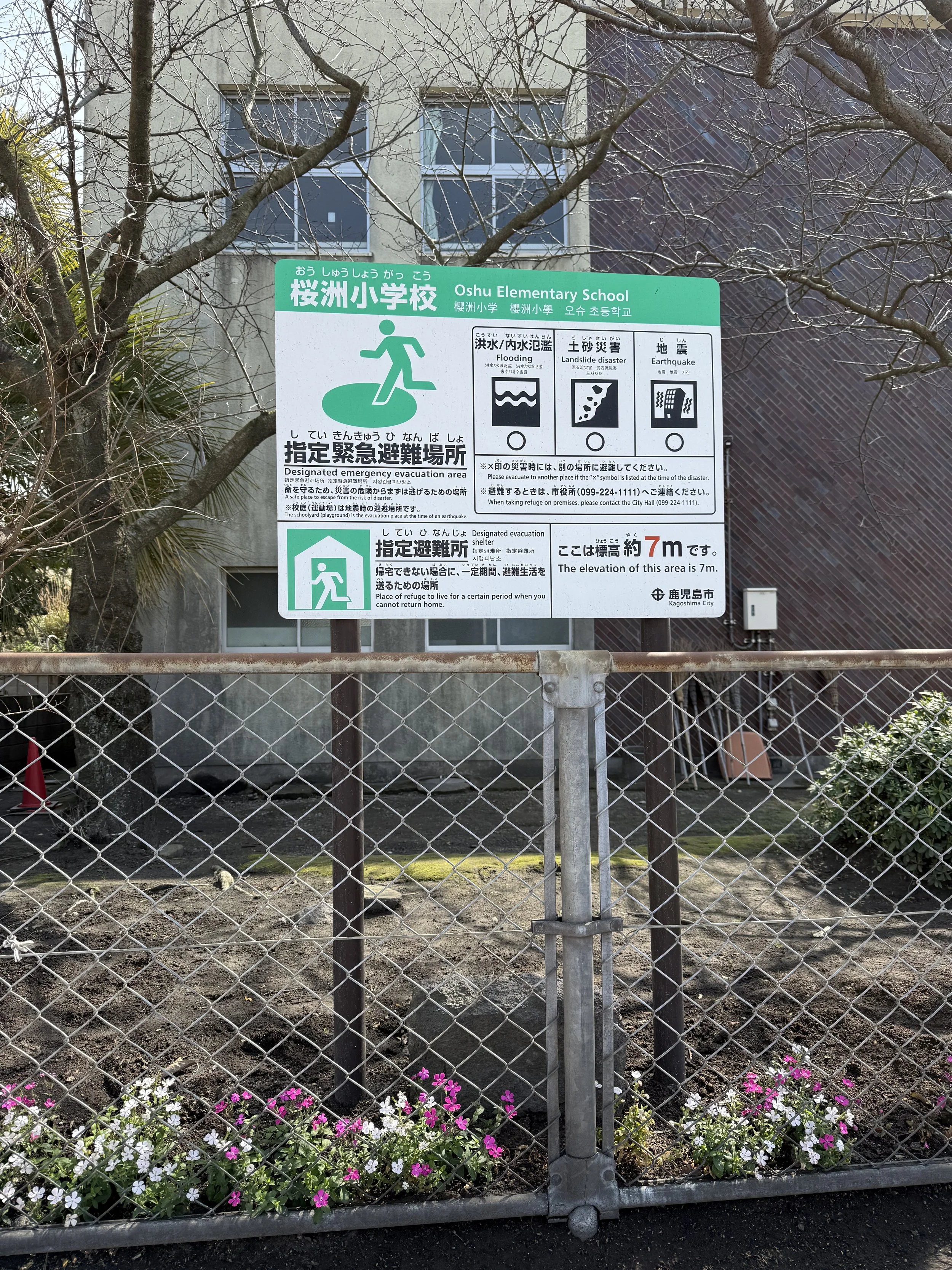
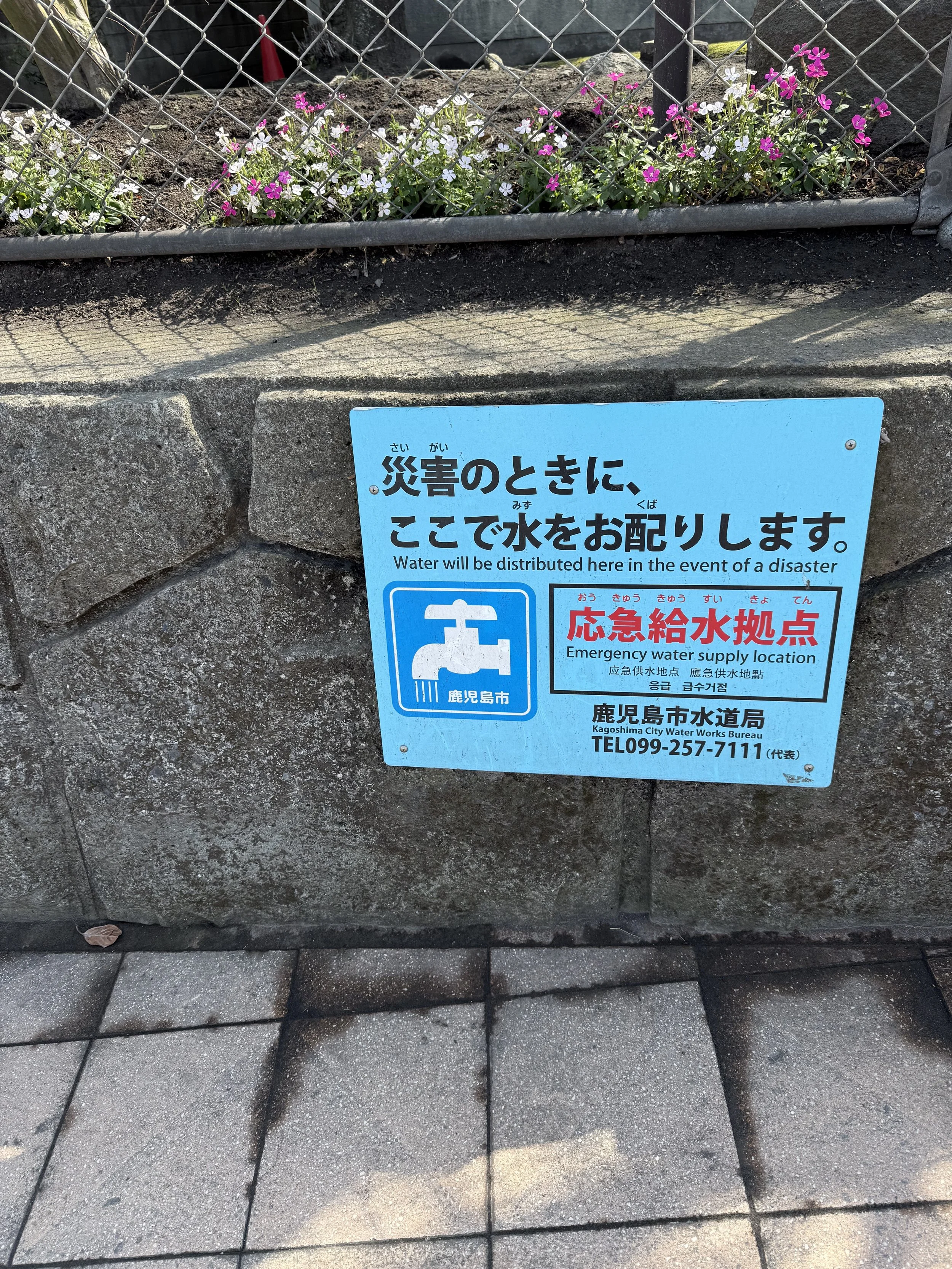
There are evacuation areas, emergency water-supply locations and extensive systems designed to control the water, mud, rock and ash that can come down the mountain. Schools are part of the emergency network. Signs explaining what to do in a disaster are simply part of the landscape.
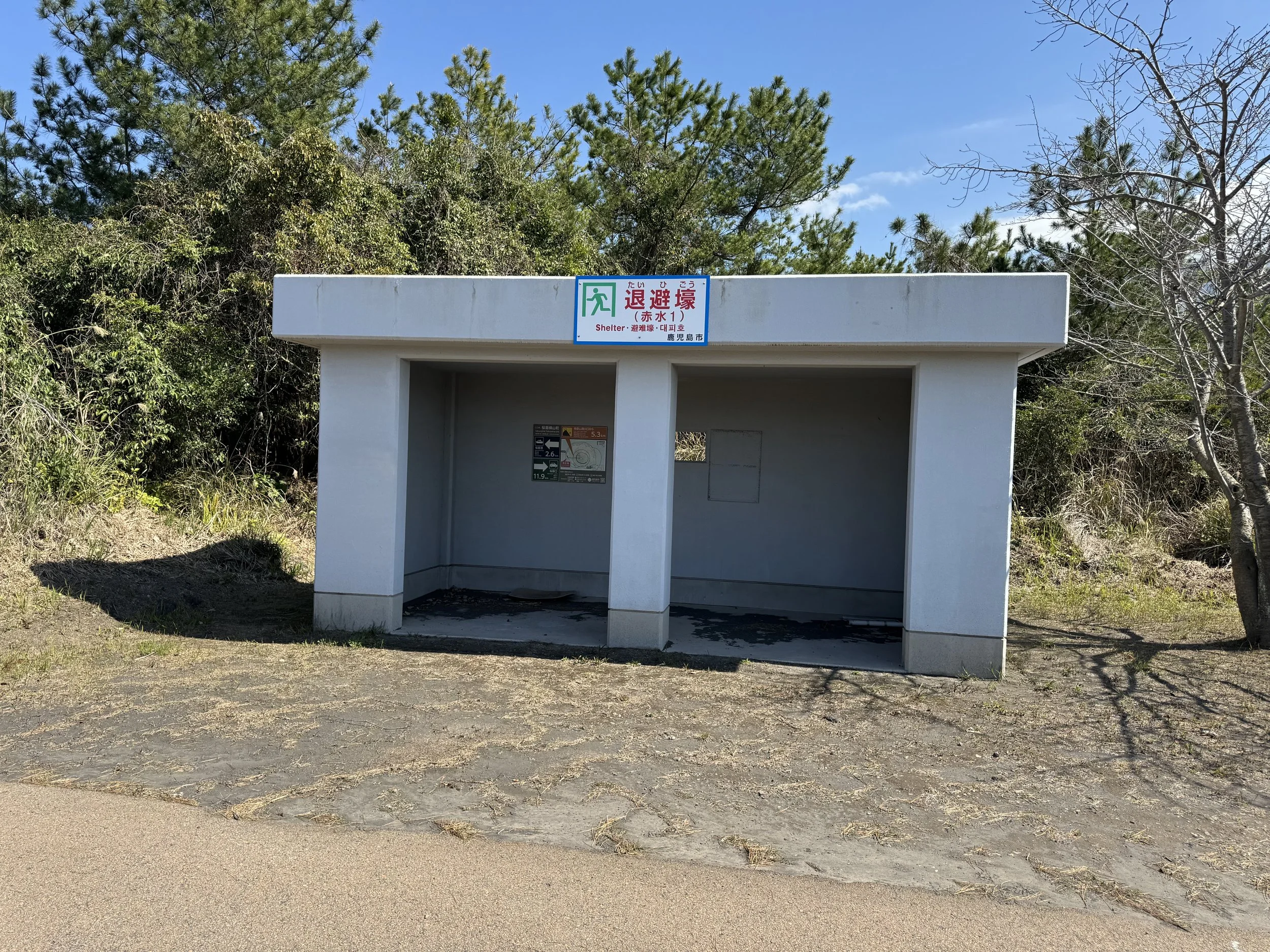
There are even concrete emergency shelters scattered along the route — simple open structures where people can get under cover if Sakurajima suddenly starts throwing something more substantial than ash.
Then we went for a bike ride.
We headed east from the ferry terminal, much of the way on a wide shared bicycle and pedestrian path. It was wonderfully easy riding — blue sky, blue water, old black lava along the shoreline and Sakurajima towering above us.
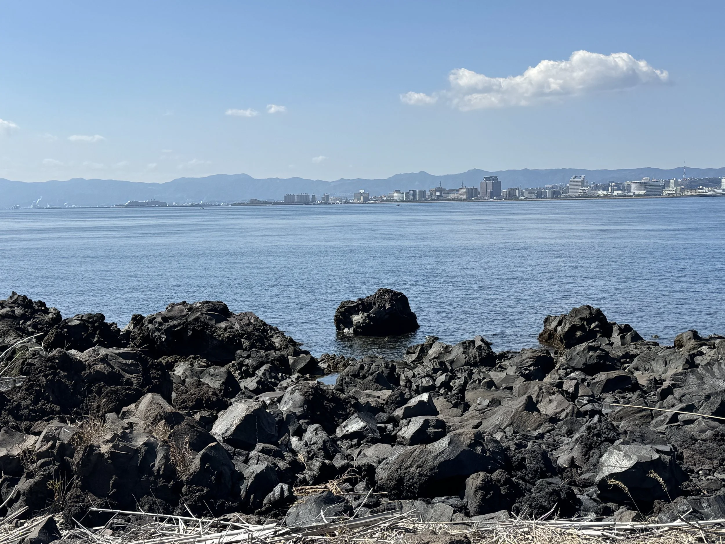
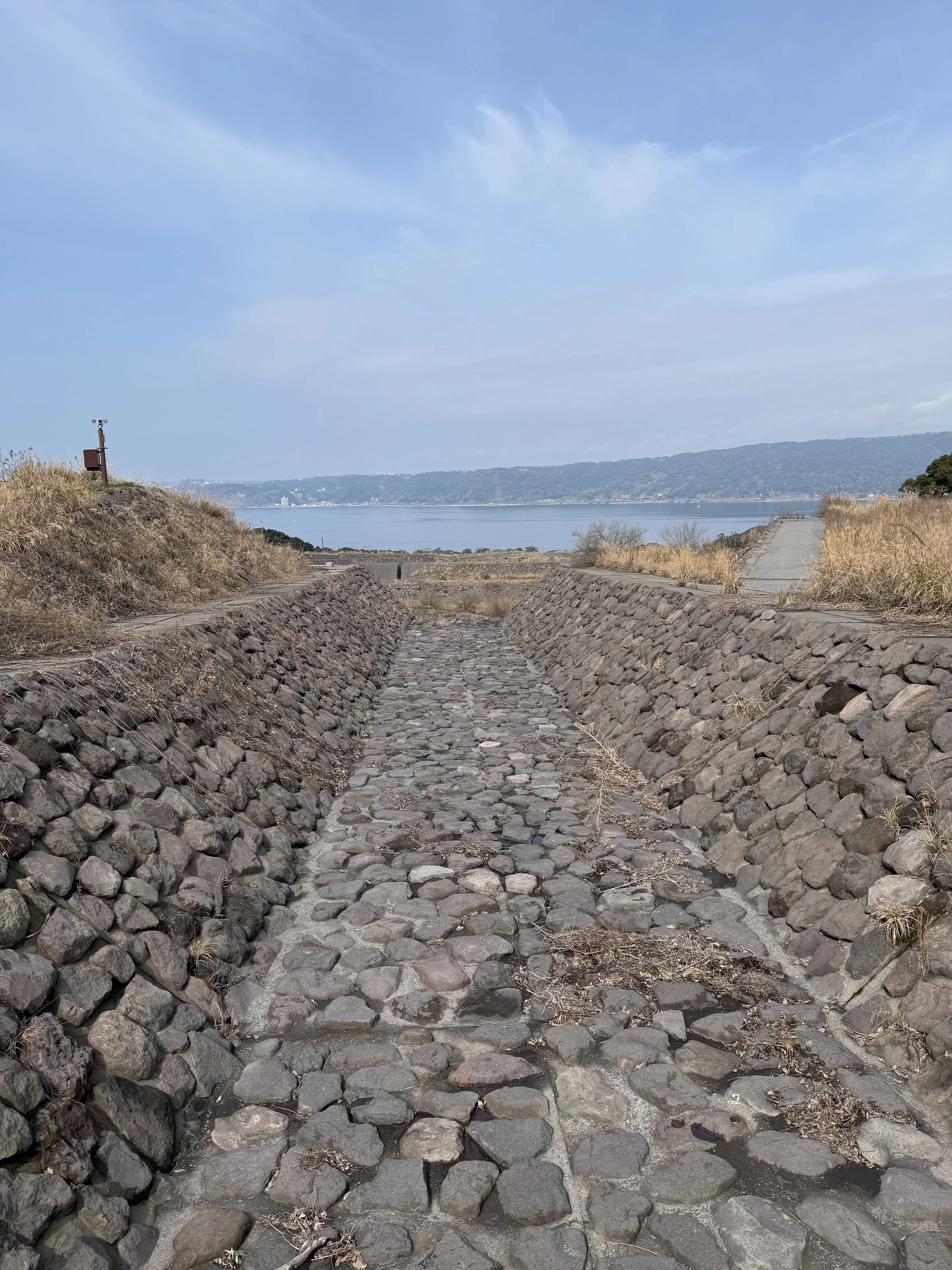
The landscape is a strange combination. It is very obviously a place shaped by violent eruptions, but it is also green, peaceful and remarkably beautiful. Pine trees and other vegetation have reclaimed much of the old lava field, while stone-lined debris flow channels cut through the landscape toward the sea.
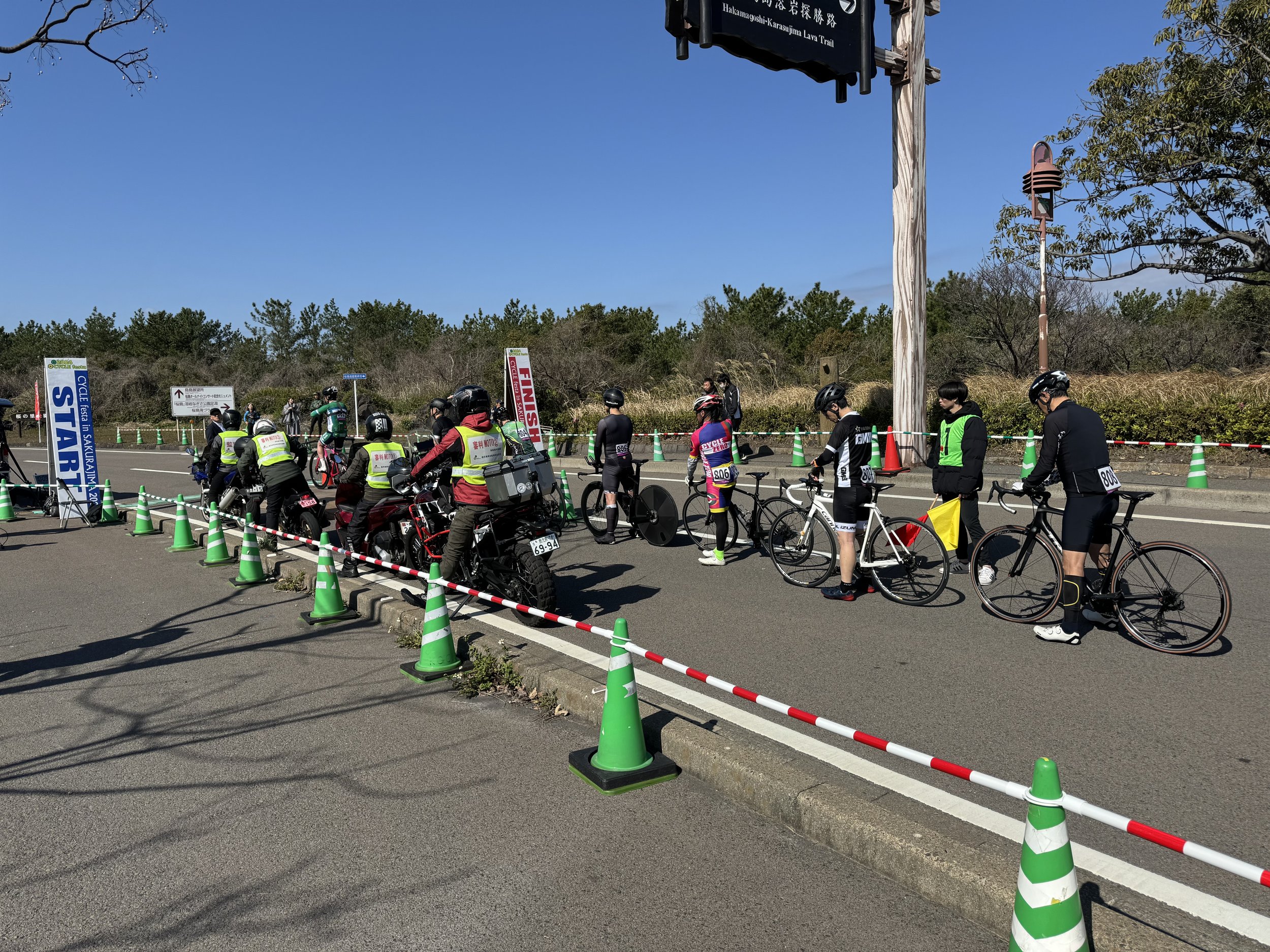
We figured out that they started near the visitor center, rode up to the Karasujima Observation Deck, and back down to the Visitor Center.
We stopped at the observation deck to watch and cheer them on while we ate a snack.
And then we stumbled onto something we had not expected at all: a bicycle race. Specifically, a time trial, where every rider races alone against the clock over a set course.
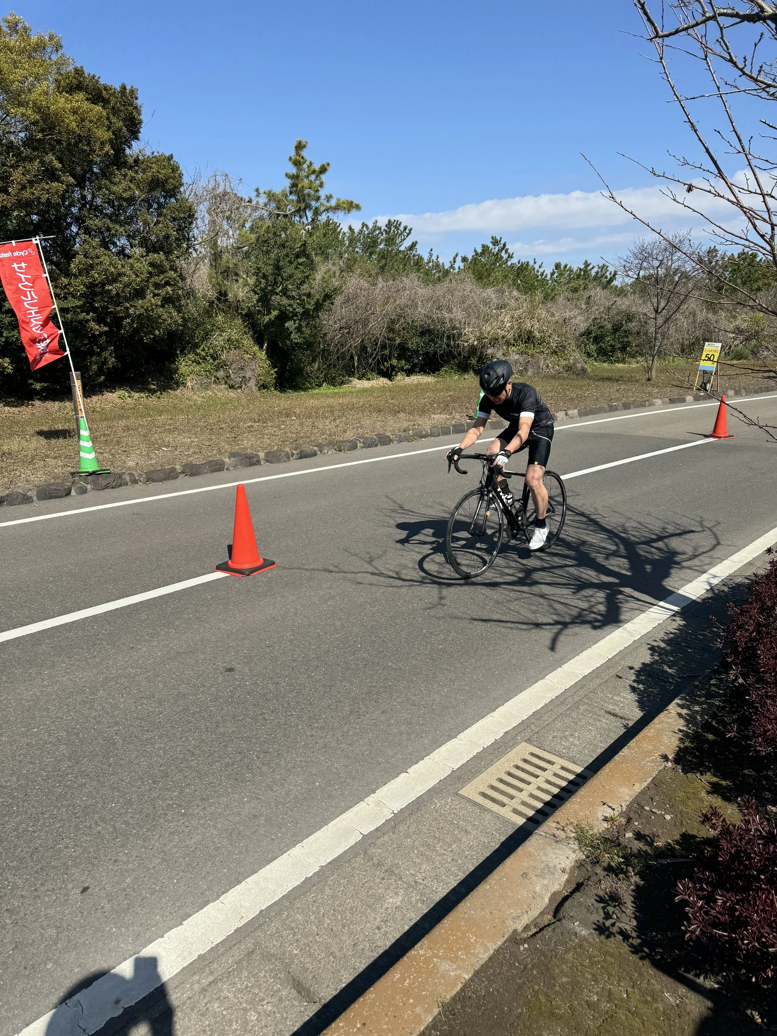
Watching other people race bicycles while we sat and ate was an excellent arrangement.
Afterward we worked our way back toward the ferry terminal and stopped at the public geothermal footbath.
This may be one of my favorite public amenities anywhere.
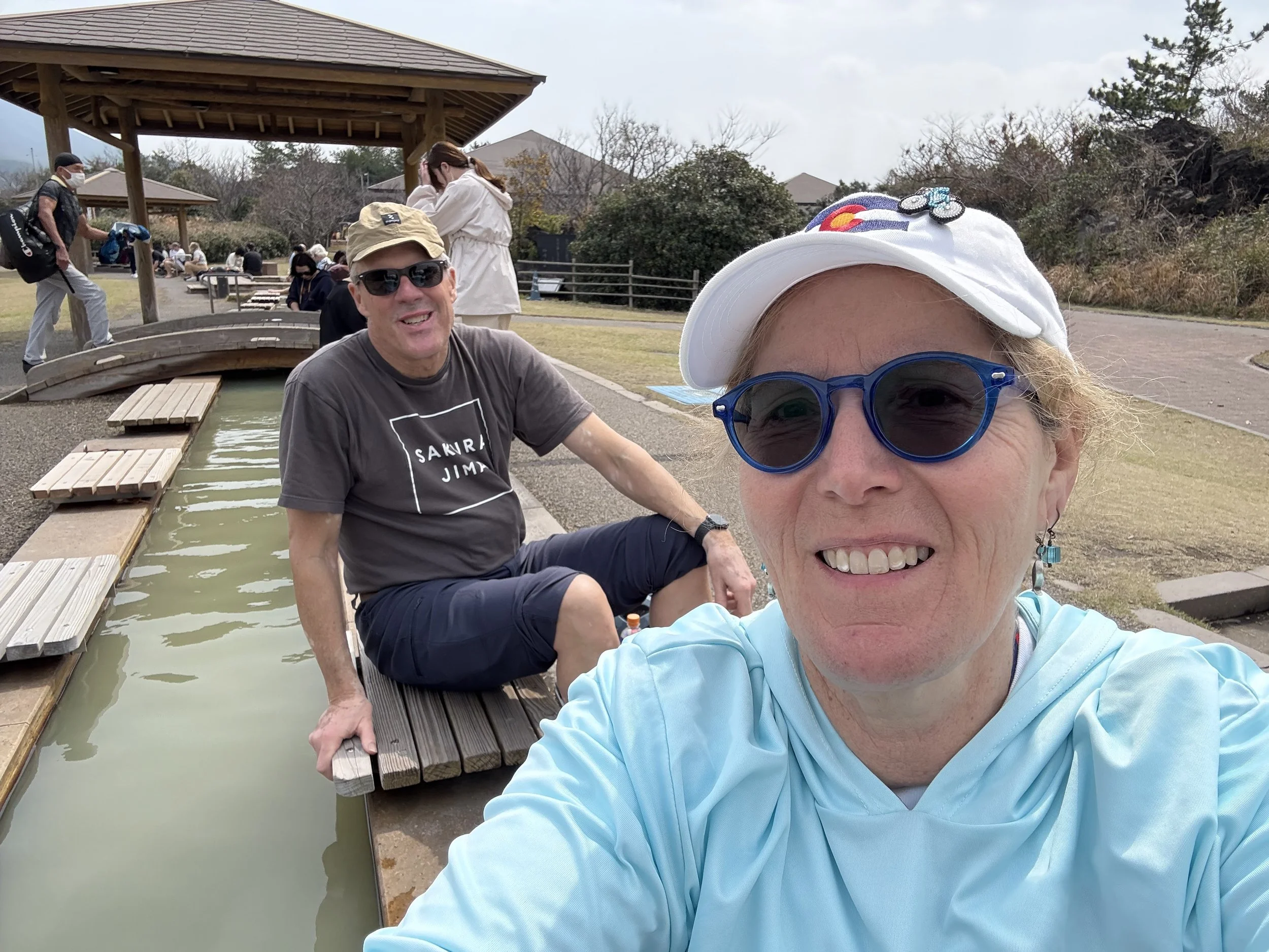
The footbath is free, long enough for a crowd of people to sit along the edge, and positioned with Sakurajima looming directly behind it. We rolled up our pants, stuck our feet into the hot water and sat there looking at the volcano we had just spent the morning riding near.
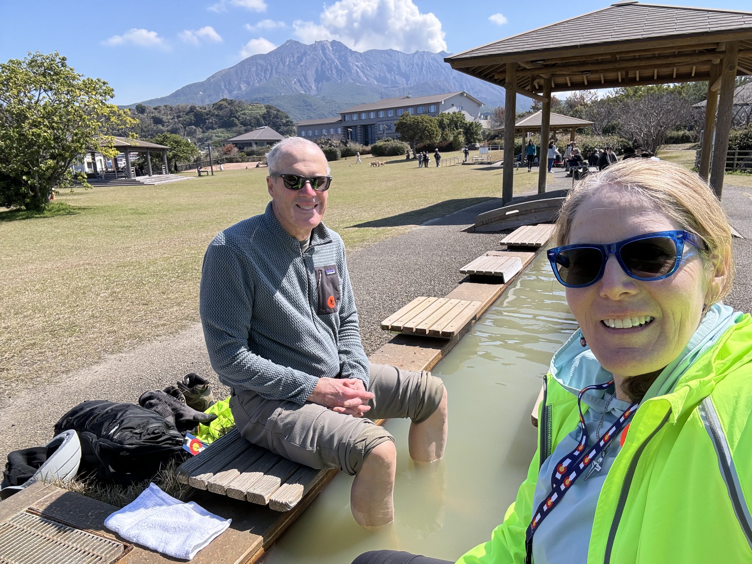
There are excellent public restrooms nearby, too, which is the sort of detail that becomes surprisingly important when you spend your vacations wandering around foreign countries on bicycles.
Eventually we took the ferry back across Kagoshima Bay and returned to the Westerdam.
Kagoshima still wasn’t finished.
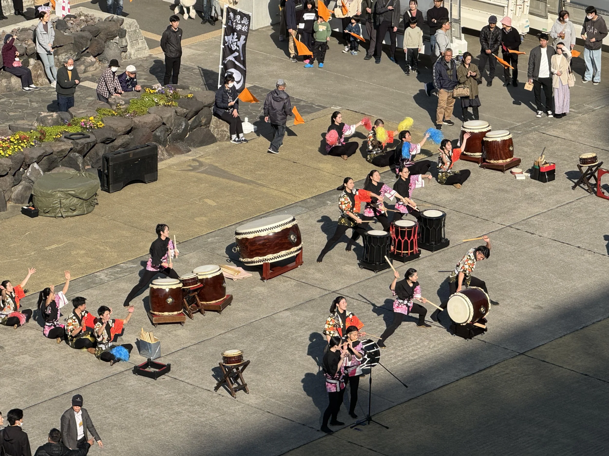
That afternoon a taiko group assembled on the dock below the ship and gave us a full drum performance as a sendoff. Passengers lined the rails while the drums echoed across the cruise terminal.
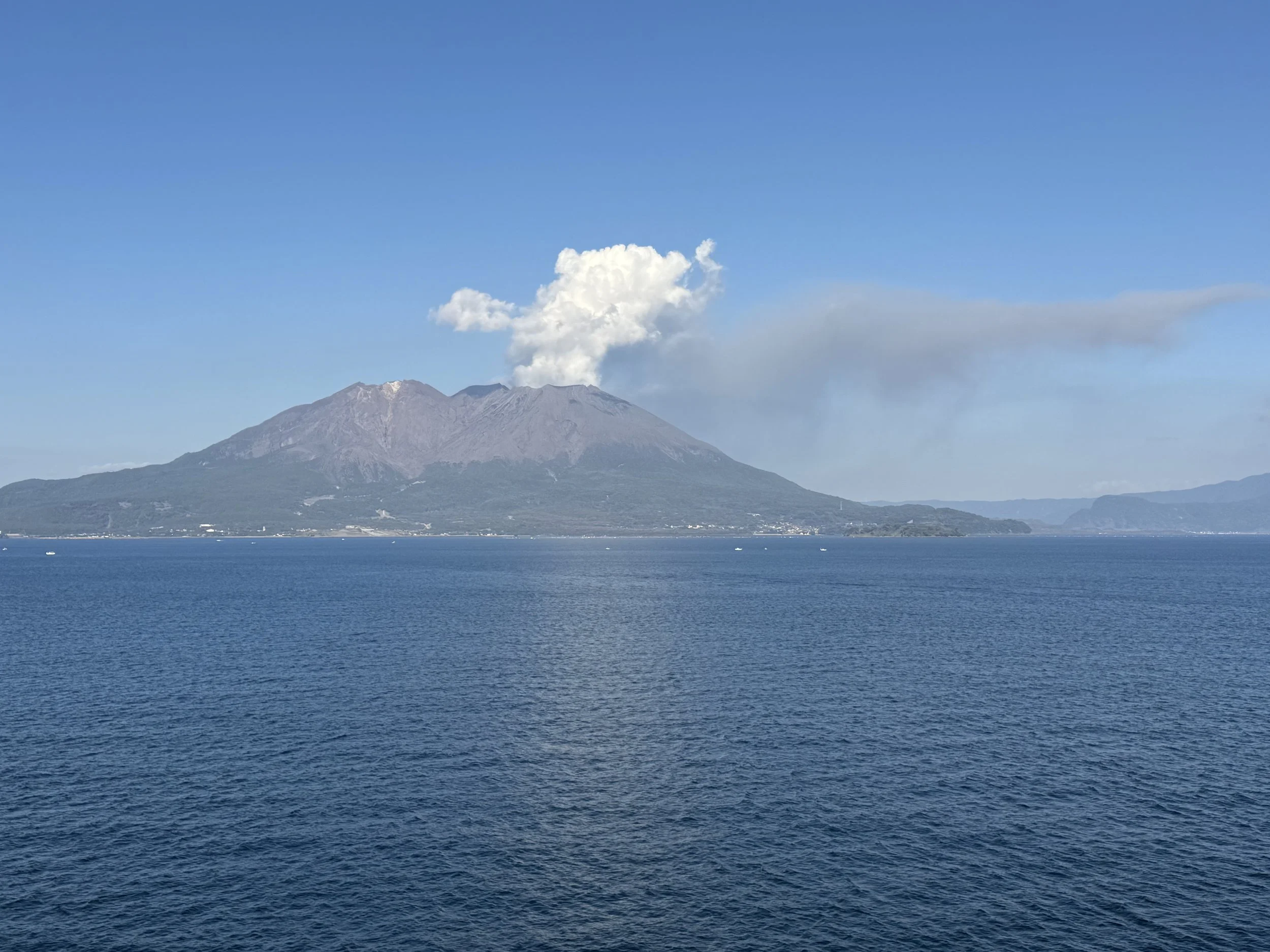
And as we sailed away, Sakurajima was still there in the late afternoon light, ash wafting from the crater.
It was a fabulous ending to the day.
We sailed away thinking, We really need to come back here.
A year later, we did.
Our Second Visit — March 2025
Almost exactly a year later, we arrived back in Kagoshima, this time aboard Holland America’s Noordam.
The weather wasn’t quite as beautiful. It was overcast, and clouds hung around the upper part of Sakurajima. Since we had already explored east from the ferry terminal, this time we decided to head north and then inland to see more of the countryside — and some of the enormous debris-control structures we had learned about on our first visit.
We rode north along the coast and then turned inland.
Along the coast we also began noticing tiny neighborhood fire stations, often close to the many evacuation points spaced along the shoreline.
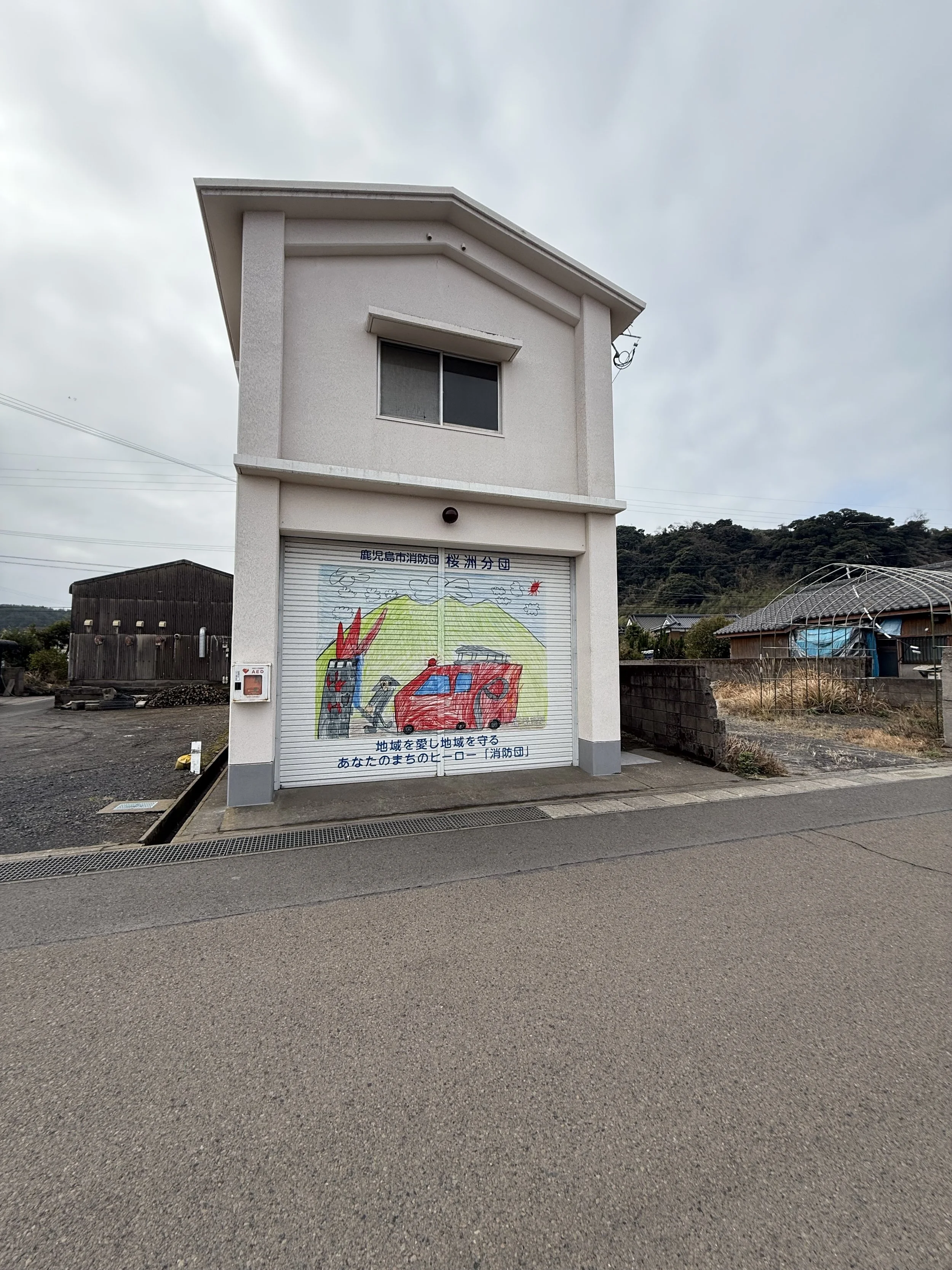
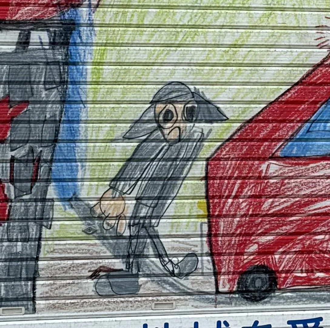
We came across several fire stations as we rode, and some had their garage doors covered with wonderful artwork drawn by local schoolchildren.
At some point we entertained the idea that perhaps we could ride the Bromptons farther up Sakurajima toward the observation area up the side of the volcano, as high as the general public is normally allowed.
YUNOHIRA OBSERVATORY
1,224 ft / 373 m above sea level
*** 5.1km climb *** 6.4% average grade *** 14% maximum grade ***
We could not.
Sakurajima is a stratovolcano. Stratovolcanoes are steep, not like the broad, gently sloping shield volcanoes of Hawaii.
We climbed for a while, but it became fairly obvious that two little folding bicycles were not going to carry us all the way up there without turning a very nice day into a painful epic.
That settled one question for future visits. Next time, if we want to go to the observation station, we will take the bus.
Once we had gained some elevation, though, we were able to work our way south again roughly along a contour line.
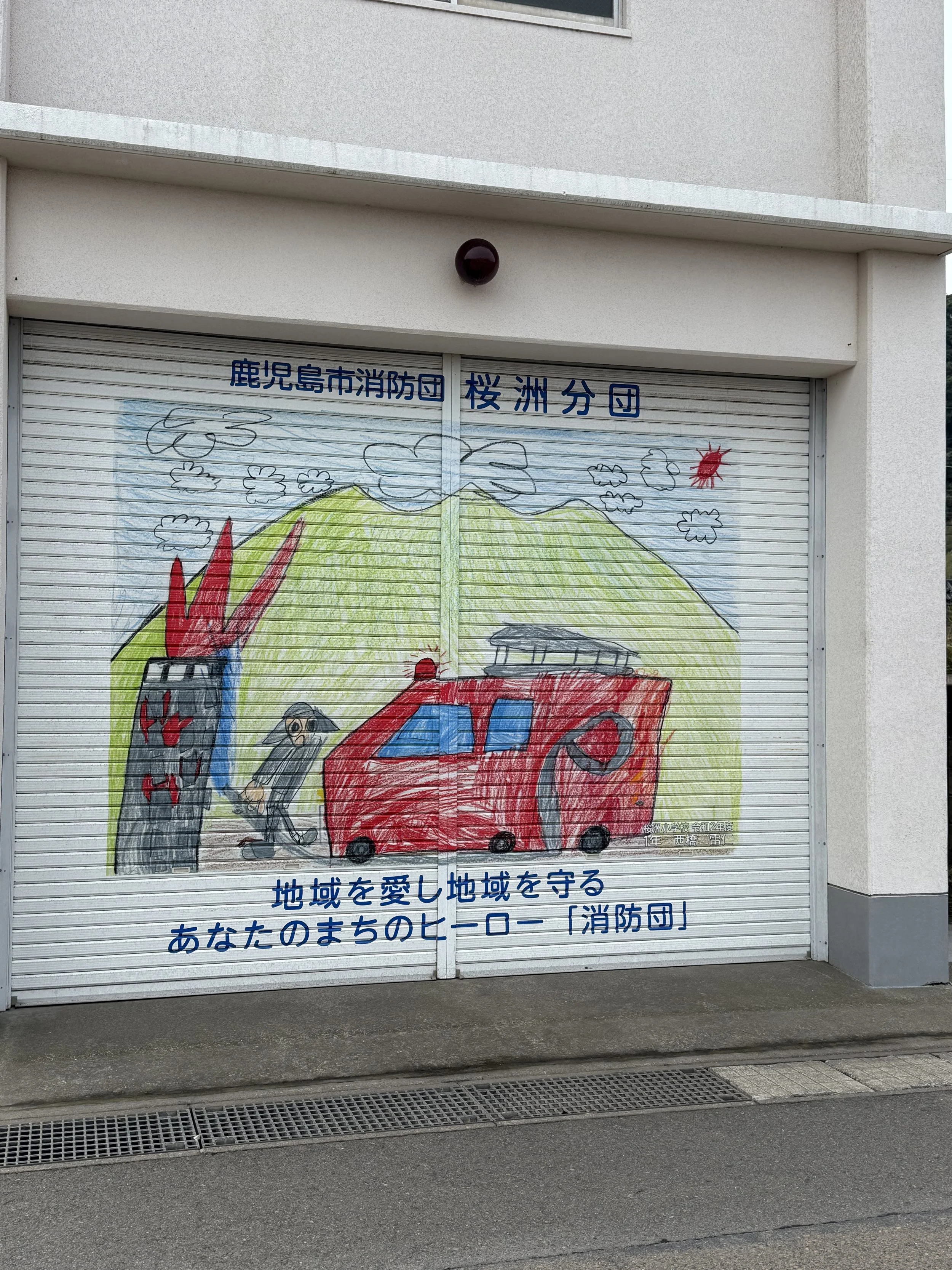
It was charming, but it also said something about the place. Even the children grow up knowing that the volcano, fires and emergency preparation are part of everyday life.
One showed a fire engine, Sakurajima brooding in the background, and a slightly alarmed firefighter confronting a blaze.
This was where the ride became really interesting.
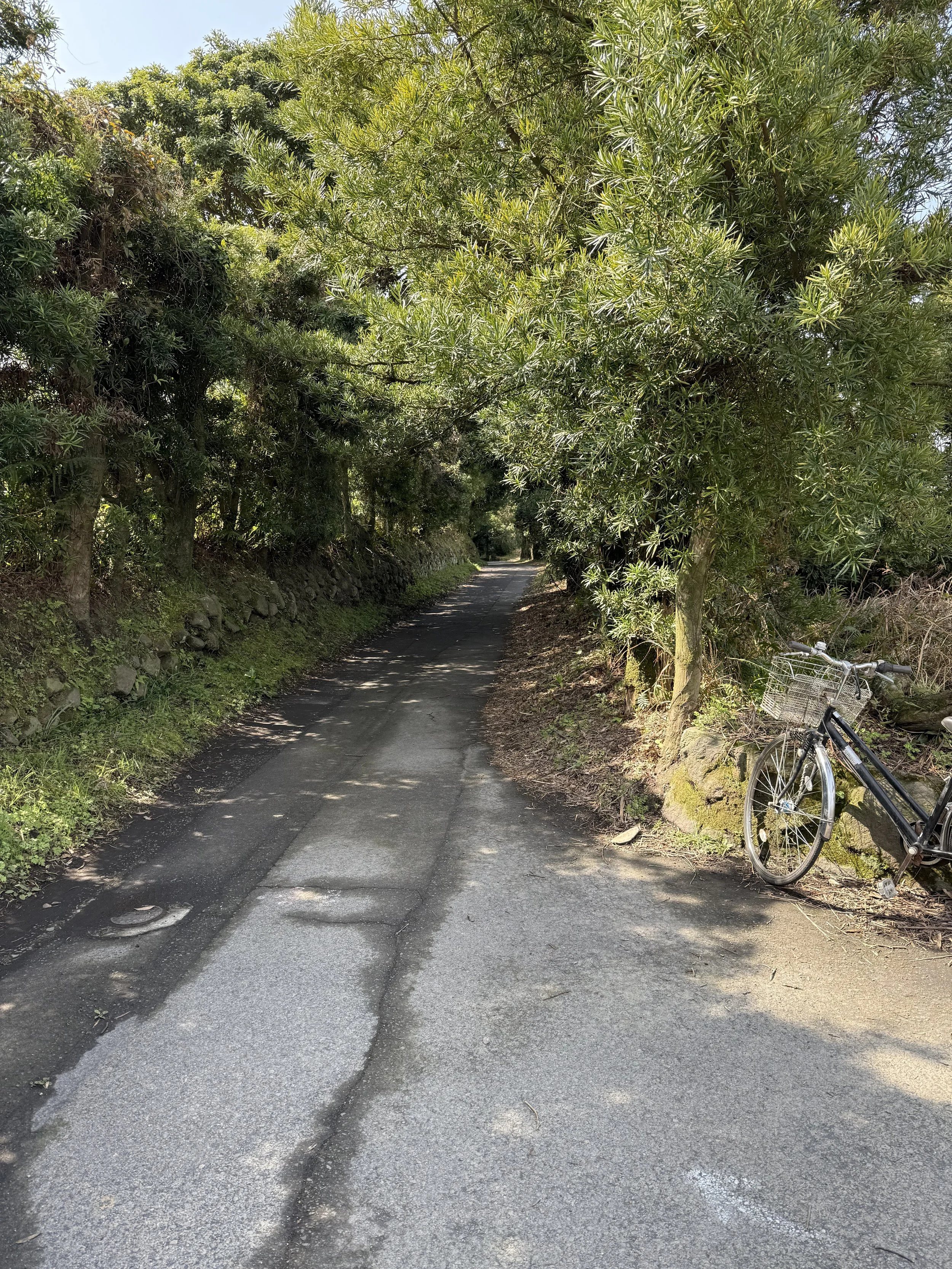
The roads narrowed into tiny rural lanes with almost no traffic. The lanes were so small that we thought surely they must be farmers’ driveways. But Google Maps and careful exploration proved they were indeed public roads—although nearly deserted. At times it felt as though we had the whole side of the volcano to ourselves.
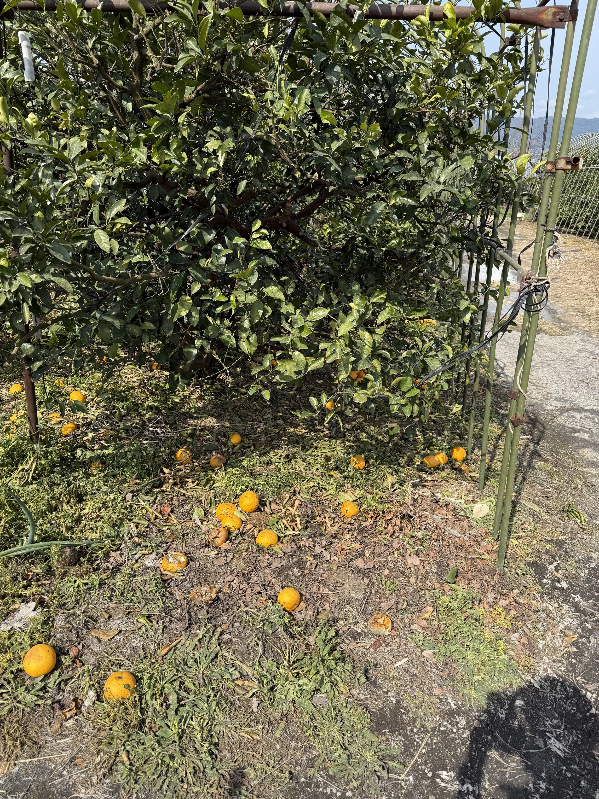
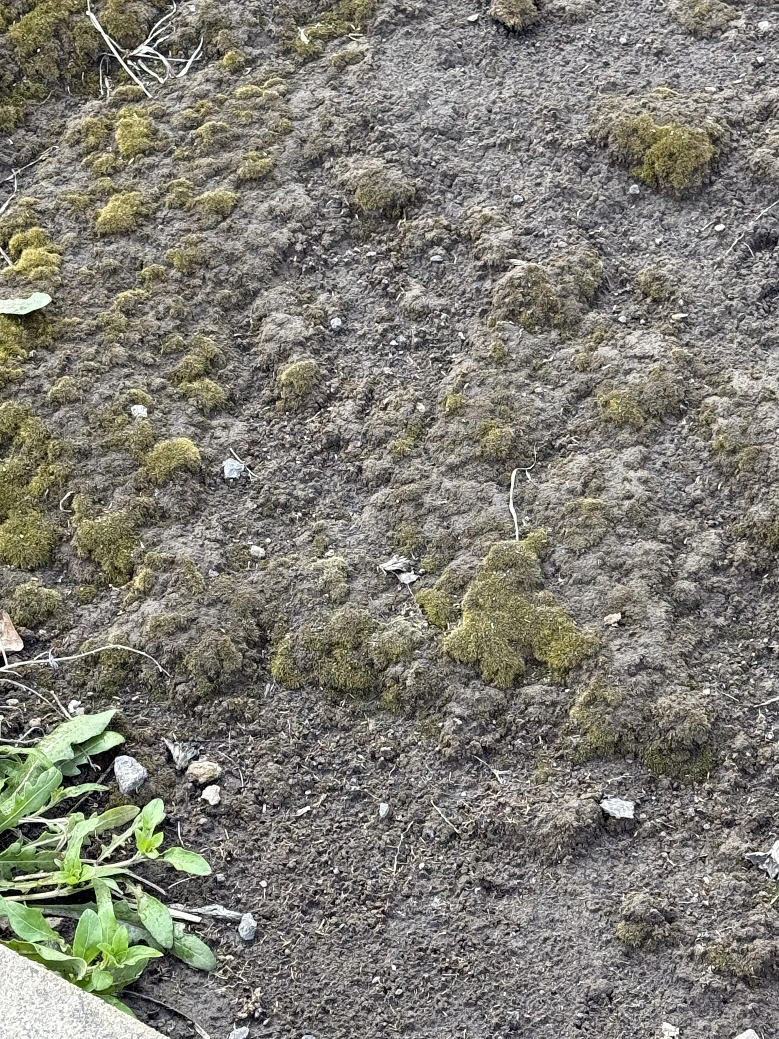
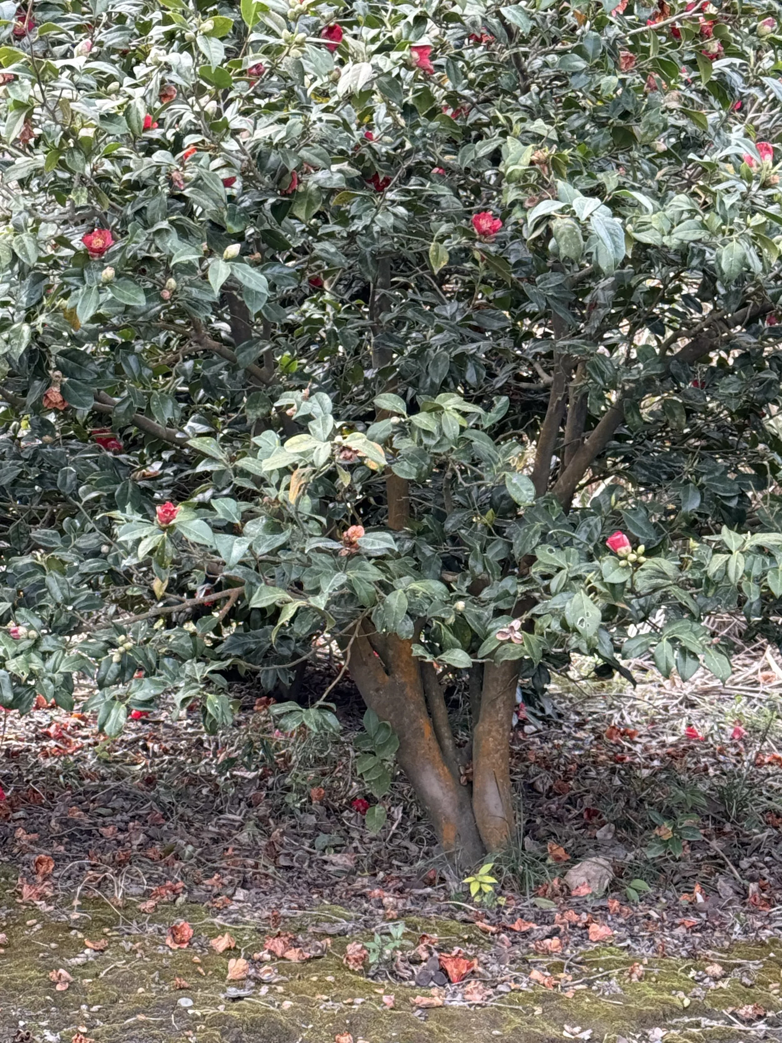
We rode past citrus trees, flowering camellias, gardens and cultivated fields, all growing in soil dusted with volcanic ash.
That was another surprise about Sakurajima. You might expect the landscape around an active volcano to look harsh and barren. Instead, much of it is intensely green and fertile, even in March. The ash is everywhere, but so are farms and gardens.
We also began seeing more of the infrastructure that makes life here possible.
Stone-lined drainage channels run down toward the sea, carrying water and volcanic debris away from populated areas. Schools double as designated evacuation areas. Signs identify emergency water-distribution points.
We traveled to Japan three years in a row, in the spring, and happened upon many different examples of disaster planning. It was all so interesting that we made a separate presentation.
At Oshu Elementary School, for example, a large sign identifies the school grounds as a designated emergency evacuation area. Nearby, another sign marks an emergency water-supply location.
It is one thing to read about living beside an active volcano in a visitor center. Riding through the neighborhoods makes it much more real.
We saw remarkably few people on these little roads — perhaps one or two for much of the ride.
Google Maps worked extremely well, which gave us the confidence to wander without worrying too much about getting lost.
Eventually we worked our way back toward the coast, stopping at a conbini for red bean buns, fresh seafood salad, and milk tea.
One of the pleasures of cycling in Japan is that there is almost always a convenience store somewhere when you need one, and the convenience-store food is actually good.
Then we returned to the public footbath near the ferry terminal.
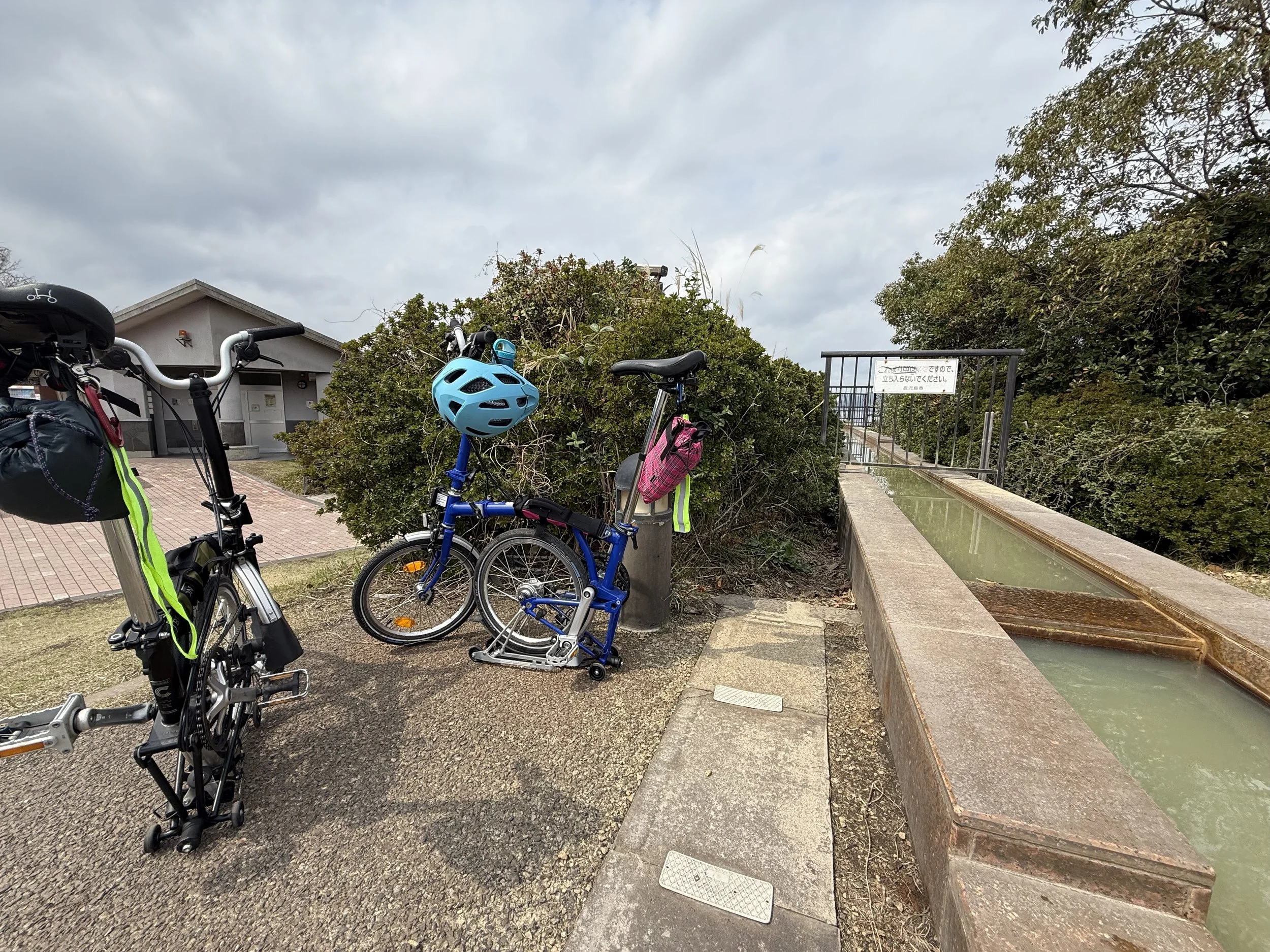
We parked the Bromptons beside it, took off our shoes, and once again sat with our feet in the hot geothermal water. John even wore the t-shirt he bought at the visitor center the year before.
By then we had spent two visits being fascinated by the extraordinary amount of preparation that goes into living beside an active volcano, so happening upon an actual training exercise felt like seeing another piece of the same story.
This time, instead of folding the bikes and taking the shuttle from the ferry terminal back to the cruise port, we decided to ride the approximately 6.6 miles back to the Noordam.
That turned out to be an excellent decision.
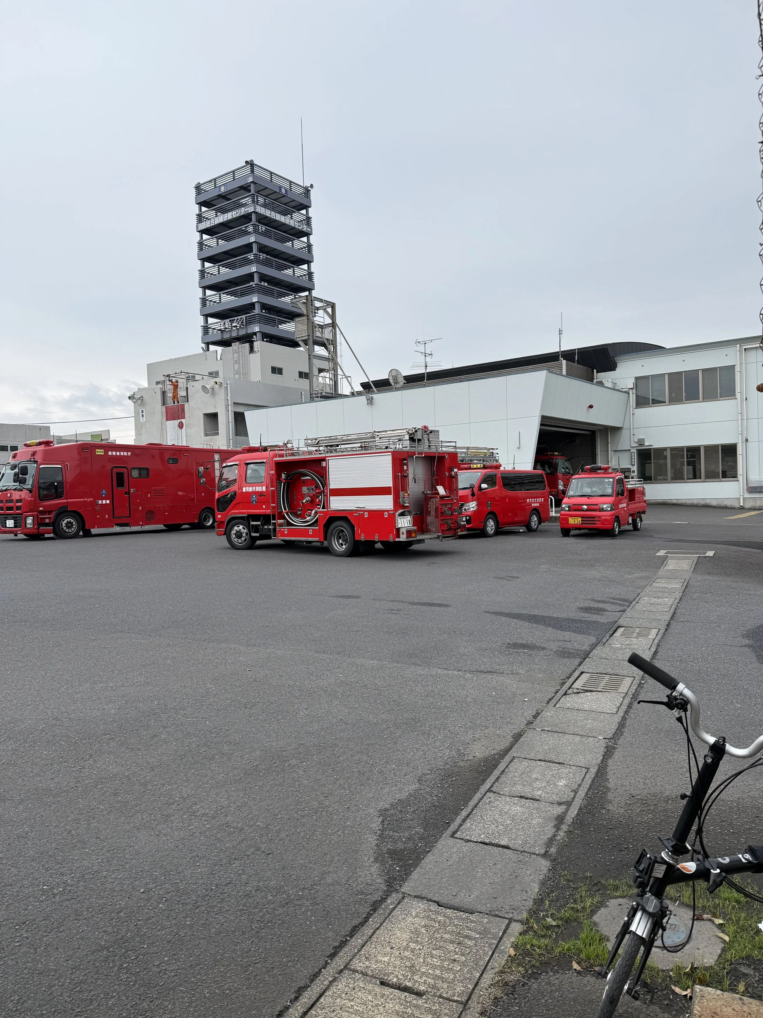
On our way back we came across a Kagoshima fire-service training facility while firefighters were actively training. There were fire engines and rescue vehicles lined up outside, and we stopped with the bikes to watch.
We met a man there who, as best we understood it, was the director of the fire department’s band.
Later that afternoon, after we were back aboard the Noordam, there they were on the dock.
The Kagoshima City Fire Band had come to play the ship away. How wonderful is it that in Japan the fire departments have bands?
They stood in their white uniforms outside the Kagoshima Cruise Terminal while passengers lined the rails above them. We had ridden past firefighters training only a little earlier, and now members of Kagoshima’s fire service were giving us a concert as we prepared to sail.
It was such an unexpectedly perfect ending to the day.
Kagoshima had given us another memorable sendoff.
The rides
March 2024: About 6.1 miles, riding east from the Sakurajima ferry terminal along the coast and returning.
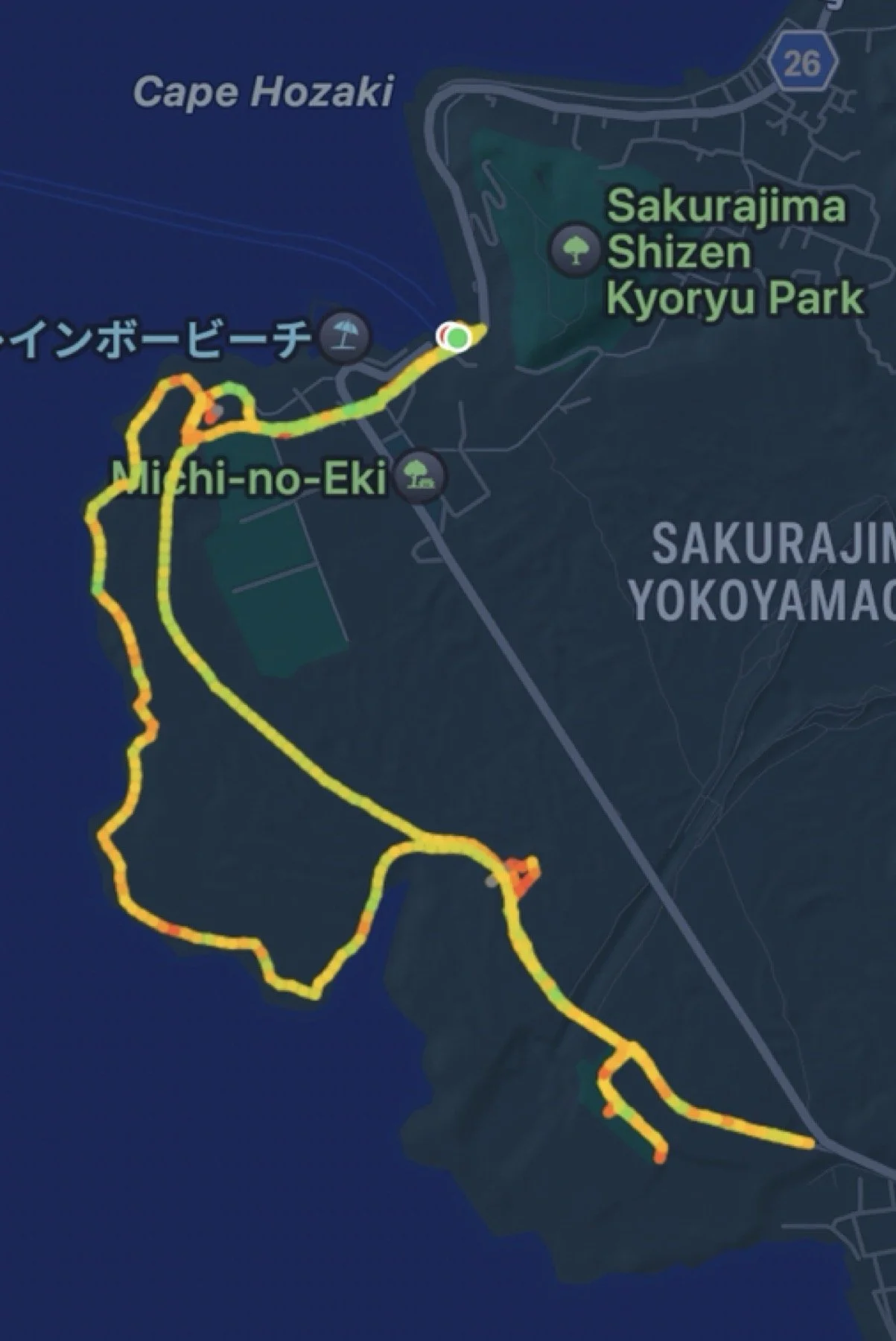
March 2025, Sakurajima: About 6.3 miles, north along the coast from the ferry terminal, steeply inland and uphill, then south through the rural interior and back to the ferry.
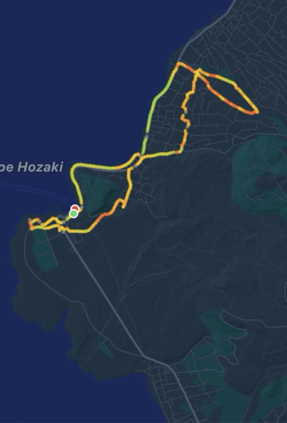
March 2025, Kagoshima: About 6.6 miles from the Kagoshima ferry terminal back to the Noordam at the cruise port.
What We Liked
Almost everything.
We loved riding on an active volcano, learning about the extraordinary amount of disaster planning that goes into living there, wandering through the quiet agricultural areas, watching the bicycle race, soaking our feet afterward, and repeatedly encountering people who went out of their way to help us.
Sakurajima is also one of those places where bicycles let us see things we probably never would have noticed from a tour bus — little fire stations, farm lanes, ash-covered fields, evacuation infrastructure and debris-control structures tucked into the landscape.
And the Visitor Center has one of the better gift shops we have encountered.
Volcanic-ash-dyed socks are hard to beat.
What We Would Do Differently
We have now established this beyond reasonable doubt: we are not riding our Bromptons up Sakurajima to the observation station.
The volcano is just too steep.
Next time, we would still bring the bikes, because the riding around the lower parts of Sakurajima is terrific. But we would use the sightseeing bus that circles the area and stops at the observation point to get higher up the mountain.
There is no particular prize for proving that two people in their sixties can push folding bicycles up a volcano. Although the lack of a prize has never stopped us before.